Wednesday, August 24, 2016

Canada - Part 3


Canada – Part 3 The Great Plains


Our last posting was all about water. This posting will be mostly about BIG things. As we travel around the U.S. and Canada, mostly on back roads and avoiding cities, we have noticed that many communities state their “claim to fame” in some fashion. Here is a sampling of what we encountered:


Eddie the Squirrel in Edson, Alberta  


Paul Bunyan's Bowling Ball in Drayton Valley, Alberta


Huge sausage in Mundare, Alberta 


World's Largest Pysanka (Ukrainian Easter Egg) in Vegreville, Alberta


UFO sculpture in Paynton, Saskatchewan


Canada's Largest Baseball Bat in Battleford, SK


Giant wheatstalk in Prince Albert, SK 


Large Radio Flyer wagon in Dundurn, SK


Snowman in Kenaston (blizzard capital of Saskatchewan)


Giant coffeepot and cup in Davidson, SK 


THE moose in Moose Jaw, SK 


World's Largest Tepee in Medicine Hat, Alberta


Largest Chess Set (verified by Guinness Book of World Records) in Medicine Hat


(Vulcan, AB was too far off our route (and we are not Trekkies) so we did not go to see the large model of the “Enterprise” at the Spock Center.)


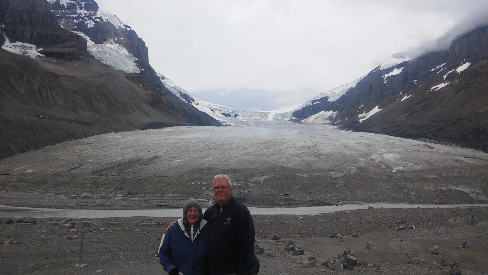
Oddball attractions were not the only places we visited. We visited three more Canadian National Parks and a few national historic sites, too.


Elk Island National Park east of Edmonton, Alberta is where we were finally able to watch some beavers. We also spent some time at the Ukrainian Cultural Heritage Village. Many immigrants from Ukraine homesteaded in eastern Alberta. We saw some old churches and the inside workings of a 19th century grain elevator.


As we were approaching Saskatoon, SK we made a spur-of-the-moment decision to head north to Prince Albert National Park – the farthest north we have been on any of our trips so far. We hiked through a peat bog on a boardwalk and enjoyed a scenic drive through the park. In the town of Prince Albert, we made a quick visit to the Evolution of Education Museum where they had Dick and Jane readers on display (are we really that old?).


From Moose Jaw, Saskatchewan, we backtracked into Alberta to attend a weekend of geocaching events in Medicine Hat. We met some friendly folks at five different gatherings, including a Flash Mob at the local Farmers Market. The landmark from almost any point in town is the Saamis Tepee and it is a grand thing to see when you are standing under it.


 Cache find #21,000 near Medicine Hat
  Hawk on the prairie


Another BIG thing we stopped to see was “Scotty” the T. rex discovered in Eastend, southern Saskatchewan.


The last few days of our Canadian sojourn has been through the rolling hills and prairies and wheatlands. They have their own special beauty just as the lakes and mountains and waterfalls do. Our last important stop was Grasslands National Park in southern Saskatchewan very close to the Montana border. It was too windy to do any hiking and the gray cloudy skies were a deterrent. We did see two black-tailed prairie dog colonies and lots of bison, some sitting on the shoulder of the road.


Prairie sunset


Other photos of interest:
  St. Patrick's Church in Medicine Hat
 Public Library - one of many we visited
  Fort Walsh National Historic Site
  Pooty's Poutine food truck
 Poutine with bacon - YUM!
 Another Saskatchewan sunset


Our time in Canada is ending. We spent 34 days and visited 9 national parks and met many friendly Canadians. It has been quite interesting to get their perspective on the upcoming presidential election and to read the local newspapers from time to time, but we won't go into any details about that in this blog.


Tuesday, August 16, 2016

Canada - Part 2


Canada – Part 2

We put the Rockies behind us for a while and headed west to spend a few days in the Okanagan Valley of British Columbia. We explored the small city of Vernon: strolled through the Farmers' Market and stocked up on fresh fruit and veggies, did other grocery shopping and surprised some geocaching acquaintances with a phone call. We met them last summer in Newfoundland and knew they lived in Vernon. We had a nice dinner in a local restaurant and enjoyed conversation with someone other than each other!
 
 
    earthnut and mrspumpkin (AKA Jerry and Donna)
 
 
We made a day trip to another city to the south – Kelowna – to attend a geocaching event there... nice people to meet. Who knows? - we may run into one or two of them again someday.


WARNING:  YOU ARE GOING TO SEE A LOT OF WATER - rivers, lakes, waterfalls, glaciers.
 
Our next leg of the trip took us through Kamloops, BC and up through the North Thompson River Valley. We spent most of one day exploring Wells Gray Provincial Park that is well-known for its waterfalls. We visited 4 of them, including one we walked behind, getting drenched even with our rain ponchos on. Hiking 2 miles back to the truck in wet shoes and clothes was not enjoyable, but the adventure of the hike was.
Spahats Falls, Wells Gray Provincial Park, British Columbia
 
Dawson Falls, Wells Gray Prov. Park
 
Helmcken Falls, Wells Gray PP
 
 
Moul Falls, Wells Gray PP - we had to hike to this one.

 
Moul Falls - you can just make out Kris to the right of the falls getting very wet back there.
 
 
Brian took this one from behind Moul Falls.

Our next stop was Mount Robson Provincial Park. It was raining when we arrived and the highest peak in the Canadian Rockies was veiled in clouds. The rain let up enough to cook a quick dinner and take showers. If you spend time in the mountains during the summer, you expect afternoon showers.
 
Mount Robson is barely visible in the clouds.
 
 
A better view of Mount Robson, highest peak in the Canadian Rockies.

We followed the Fraser River, making stops at more waterfalls until we passed Moose Lake and crossed the provincial border into Alberta and Jasper National Park. We hiked through Maligne Canyon and saw Medicine Lake – a “disappearing lake”  that is only full when melt water from the glaciers enters the lake faster than it drains out through underground fissures and re-emerges farther down the valley. We traveled the northern portion of the Icefields Parkway from Jasper to Athabasca Glacier, stopping at more waterfalls along the way. We couldn't walk out on the glacier without paying for a guided walk, but we got pretty darn close. There are markers along the trail with the years of previous locations of the “toe” of the glacier so we could see how far it has retreated. Another hike on the “Path of the Glacier Trail” led us to the base of Mt. Edith Cavell and a good view of Angel Glacier and a small lake of melt water with small icebergs floating in it. We were close enough to see the blue-green color in the ice.
Fraser River, BC
 
Fraser River
 
 
Moose Lake, British Columbia


Maligne Canyon, Jasper National Park, Alberta
Medicine Lake, Jasper NP
 
 
Stutfield Glacier, Jasper NP
 
View of Athabasca Glacier from the Visitor Center
 
Athabasca Glacier - as far as we could go without a guide.
 
"Glacial Polish" on bedrock - evidence that a glacier once dragged rocks and made scratches. The scratches are perpendicular to the layers in the rock.
 
 
Sunwapta Falls, Jasper NP
 
Angel Glacier, Mt. Edith Cavell, Jasper NP
 
 
Glacial meltwater with small icebergs at the foot of Mt. Edith Cavell
 
We hope you can see the layers in the ice and the blue-green color. 
 The trail down there was closed, but a lot of other people went down there anyway.
 
We left the mountains behind and headed east toward Edmonton. Our plans for the next week are somewhat nebulous but will include some time in Saskatchewan, the only province contiguous to the U.S. that we have not visited yet. We are so very fortunate to be able to make this journey and see these wonderful places.