August 22, 2019 Mostly Michigan (and a little of
Indiana)
We spent three days at Indiana Dunes
National Park (the newest National Park, formerly known as Indiana
Dunes National Lakeshore). It is at the southern end of Lake
Michigan just east of Gary, IN – Chicago is just visible to the
northwest. Our first point of interest was the 1933 Century of
Progress Homes that were moved to the exclusive community of Beverly
Shores after the Chicago Exhibition. They are privately owned on
prime lakeshore real estate and quite interesting to view from the
road and read about them on NPS information signs. We did some
hiking in the park, viewed a sunset, and tried to tune out the train
whistles from the nearby commuter line. We made geocaching trips into
Illinois and nearby Indiana counties. (Geocaching is never far from
our minds.)


Bailly Homestead and Chellberg Farm, Indiana Dunes NP


Hiking at Indiana Dunes NP - it's not all sand dunes! Kris in middle of photo

Evening dune reflection

Sunset over Lake Michigan

parking lot side of Mount Baldy dune

lakeside of Mount Baldy dune - early morning shadows

looking down on the beach from Mount Baldy trail
We left Indiana and drove up to Battle
Creek, Michigan where we camped at Fort Custer State Park next door
to a national cemetery. We visited the “Avenue of the Flags” at
the cemetery in the early evening with the sun low in the sky. We
visited the Gerald Ford Presidential Library and gravesite in Grand
Rapids. It is separate from the presidential library that we visited
in Ann Arbor.

Fort Custer National Cemetery - Avenue of Flags


Ford Presidential Museum, Grand Rapids


Entrance Hall of the museum

Gravesite of President and Mrs. Ford
Feeling the need for more nature, we embarked on the River Road National Scenic Byway in
Huron National Forest. Great views along the Au Sable River and the
Lumbermen's Monument Visitor Center was a great place to spend some
time. The sculpture is quite impressive at 15 feet in height.

Au Sable River, Huron NF


Lumberman's Monument

Our next stop was Lake City, MI to
visit friends, Carol and Craig, who used to live in Houston and teach
with us at Clear Lake City Elementary. We visit every time we pass
through Michigan and had a great visit with them at their lakehouse
on Lake Missaukee. A pontoon boat ride, a tour of Craig's hometown,
and sunset-viewing from their deck were the highlights.

Late afternoon from the deck of the lakehouse

Captain Craig on Lake Missaukee
We took another day to see the sights
of the northeastern part of the lower peninsula passed through the
Elk Capital of Michigan – Atlanta. We camped at Clear Lake State
Park and enjoyed the hiking trails and some very cleverly constructed
geocaches.

Sturgeon Point Lighthouse

one-room schoolhouse at Sturgeon Point

geocache at Clear Lake State Park - pull the handle to reveal the ammo can in the "drawer"

S.S. Calamity

"Hoist the Anchor" - cache container is attached to a chain that you pull out of a tube in the ground.

We finally found the tiny metal box with the key to open the "secret compartment" to get
the logbook out to sign.
Before crossing the Mackinac Bridge to the Upper
Peninsula, we stopped to visit Cross in the Wood Shrine near Indian
River. Huge crucifix and shrines to a few other saints along the
paths in the woods was a restful place to spend an hour.

The cross is 55 feet tall and made from a redwood tree. The bronze Corpus is 28 feet.

Holy Family sculpture
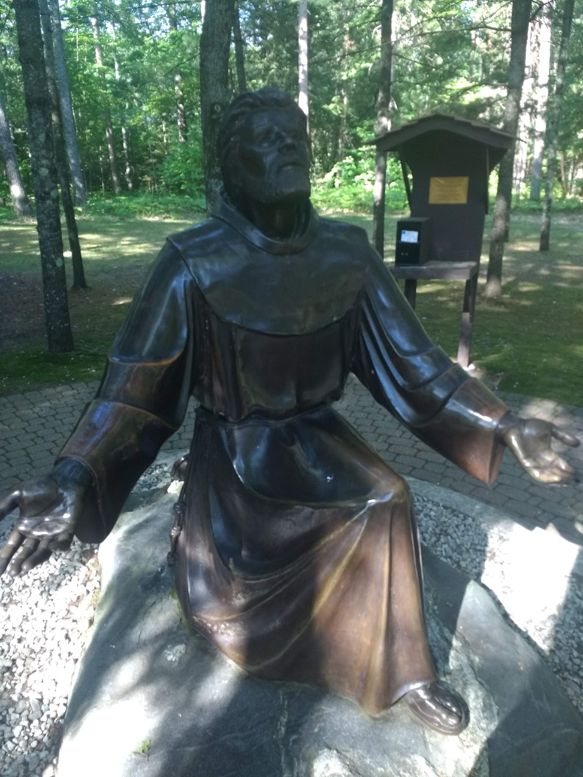
St. Francis Shrine
We arrived in Hiawatha National Forest
to camp and build our first campfire of this trip. The temperature
dropped to low 40s by morning. The sound of loons on Soldier Lake
was most welcome. Our destination that day was Whitefish Point on
Lake Superior to visit the Great Lakes Shipwreck Museum. We didn't
have time to get up there on our last visit to the UP in 2013. We
also wanted to find a geocache up there places by some fellow
Houstonians. We had offered to perform maintenance on it for them in
a conversation we had some months ago, but they had plans to be up
there to do it themselves. As we were approaching the site of the
cache, we were astounded to find Rich and Lola were there at the same
time. As we swatted mosquitos, we chatted a short bit then met up
with them at the shipwreck museum. We viewed the bell from the wreck
of the Edmund Fitzgerald and a film about how the Canadian Navy
helped to raise it and lower a replica bell that is now the marker
for the 29 men who died when the ship sank in 1975.

Our beautiful campsite on Soldier Lake, Hiawatha National Forest

Chance meeting at Whitefish Point


Whitefish Point Light Station


Second order Fresnel lens


diving suit used to raise the bell

huge wooden rudder

After leaving Whitefish Point, we joined the throngs of people to visit Tahquamenon Falls.


lower falls


Sunset from our campsite at Colwell Lake (Hiawatha National Forest):

A location we happened across in 2013 was Lakenenland. We liked it very much so made a repeat visit to see what has been added. (See the Special Edition post to see our photos.)

After three days at Van Riper State Park, it was time to head up the Keewenaw Peninsula to Copper Harbor so we could take a boat trip out to Isle Royale National Park. Our original plan was to take the shorter trip from Grand Portage, Minnesota but no spots were available until late September, so.... departure from Copper Harbor was the other option and resulted in an extra week up on the UP - not really a bad thing. However, on short notice, we had to settle for a day trip to the Rock Harbor end of the park. 3.5 hours (56 miles) by boat out there, 3 hours on the island, 3.5 hours back to Copper Harbor. We left under sunny skies, experienced a rough crossing, arrived at IRNP in the rain, had only enough time to do a 2-mile hike on a sloppy trail, a smoother crossing on the way back. Live and learn, right? We want to go back to this rugged, isolated wilderness in the future and plan farther in advance and visit the Windigo end of the island. We have now visited 46 out of 61 national parks . . . still a few on the bucket list.

leaving Copper Harbor . . .

. . . and looking out to Lake Superior

Seen while hiking the Stoll Memorial Trail from Rock Harbor, Isle Royale


leaving Rock Harbor
On the way to Copper Harbor, we stopped at the Shrine of Bishop Frederic Baraga, the "Snowshoe Priest." It is6 stories tall and the snowshoes on the sculpture are 26 feet long. Equally impressive it the location overlooking Keewanaw Bay.


After leaving Copper Harbor, we drove back down the Keewenaw Peninsula toward Ottawa National Forest just north of the Wisconsin state line and stopped at a few sights we remember from our 2013 trip.

snowfall gauge - record is 390 inches; the red arrow is pointing to last winter's total

one of three stone ships built by WPS in the 1930s next to informational panel about the four versions of USS Kearsarge in Kearsarge, MI


Keewenaw National Historical Park in Calumet, MI

Next stop, Sault St. Marie to visit the Soo Locks and move on into Ontario to explore the north shore of Lake Superior on the way to Grand Portage, Minnesota. 80 days and 13,000 miles so far . . . and we are still heading AWAY from home.
Seen while geocaching:

cemetery in Indiana

"Mighty Mac" bridge seen from St. Ignace

cooking breakfast at a roadside park on Lake Michigan

U.S. Ski Hall of Fame in Ishpeming, MI
Unfortunately, it was closed so we couldn't visit the museum.


ore dock in Marquette, MI

roadside park along Lake Superior; a bit later I looked out my window and saw a bald eagle flying parallel to us for about 20 seconds

Another roadside park on Lake Superior - early morning is the best time of the day!

U.S. Highway 41 ends about 1 mile past our campground at Fort Wilkins St. Park

Brian at a geocache published 19 days before he signed the clean logbook for "First to Find."
We only went a "little out of the way" for this opportunity.
No comments:
Post a Comment