June 20, 2023
With the first 887 miles of the Alaska Highway behind us, I am in the public library in Whitehorse, Yukon to update this blog. We plan to cross into Alaska in two days. The weather is warm and sunny today, but we encountered sleet and snow two days ago. The highway so far has been good with just one half-mile stretch of gravel where repairs were made in a rockslide area. We hope this is an indication of what is to come.
Since our last blog posting, we started off on the Alaska Highway at Mile Zero in Dawson Creek, British Columbia.
Pretty light out at 4:30 a.m. but we were ready to get on the Alaska Highway!
What you hear about rock chips on the Alaska Highway is true.
This one happened on our first day.
 |
| Lots of wildfire smoke between Dawson Creek and Fort Nelson, BC |
We observed many helicopters with dangling water buckets.
From Fort Nelson, we made a detour of 84 miles to Northwest Territories... when are we ever going to be this close again?
Of course, we had to find the geocache there.
Unusual construction method for an outhouse at the territorial border.
We saw lots of wildlife along the road. We drove that highway early in the morning so we saw more bears than vehicles. In fact, we didn't see any other vehicles until we were on our way back south to the Alaska Highway.
We saw this lynx sitting in the middle of the road, but luckily it didn't
move too far away as we approached.
One of 4 bears we saw that morning. We also saw an elk cow with calf
and several wood bison.
We camped at Stone Mountain Provincial Park on the shore of Summit Lake. We woke to slushy sleet on the windshield and encountered a snow flurry a few miles down the highway. We thought we might have to skip a soak in the Liard River Hot Springs because of this weather, but as we descended in elevation, the weather improved.
Liard River Hot Springs, one of the popular stops along the Alaska Highway and the reason
I packed our swimsuits.
Continuing westward, we saw several more bears and groups of bison (with calves), but have not seen any moose yet.
Next major milestone was the Yukon border. This informal wooden sign was covered in stickers so we had to add ours. (We bought the stickers at Buc-ee's in Madisonville, TX on our ill-fated first attempt on this trip. We intended to distribute them at an event in Saskatoon, but that plan fell through.)
We came prepared for another popular stop in Watson Lake - Sign Post Forest. We had a metal Texas flag that we purchased when we hoped to make this trip five years ago. After a recent visit to our college alma mater, we also brought the license plate holder the Alumni Association gave us. There are 100,000+ signs there now, so finding a spot to install ours was challenging. We ended up putting it sideways while another visitor who didn't speak English indicated she wanted to take a photo of us while putting it up. If any of you reading this are ever in Watson Lake and want to find our sign, good luck - there are thousands from all over the world.


We stopped at a First Nation community of Teslin and visited the George Johnston Museum. George's life was quite interesting. He bought a mail order camera in the early 20th century and taught himself photography and how to develop his own pictures. He spent years documenting the lives of his people through black and white photos. In 1928, he bought an automobile and had it barged into this roadless town, hand-cleared a three mile "road" (later used by the engineers of the Alaska Highway in 1942) and drove it on the 90-mile Teslin lake in winter. The museum had nice displays of Tlingit artifacts as well as the car itself.
 |
| George Johnston Museum in Teslin, Yukon |
Tlingit button blanket
It took a lot of gophers to make this blanket!
We are now in the Yukon territorial capital of Whitehorse, population 27,850 (The whole territory has only 44,000 people.) Quite an interesting city to visit and a nice variety of attractions. We will leave in the morning to continue our journey to Alaska.
Canoeists in Miles Canyon
Columnar Basalt in Miles Canyon
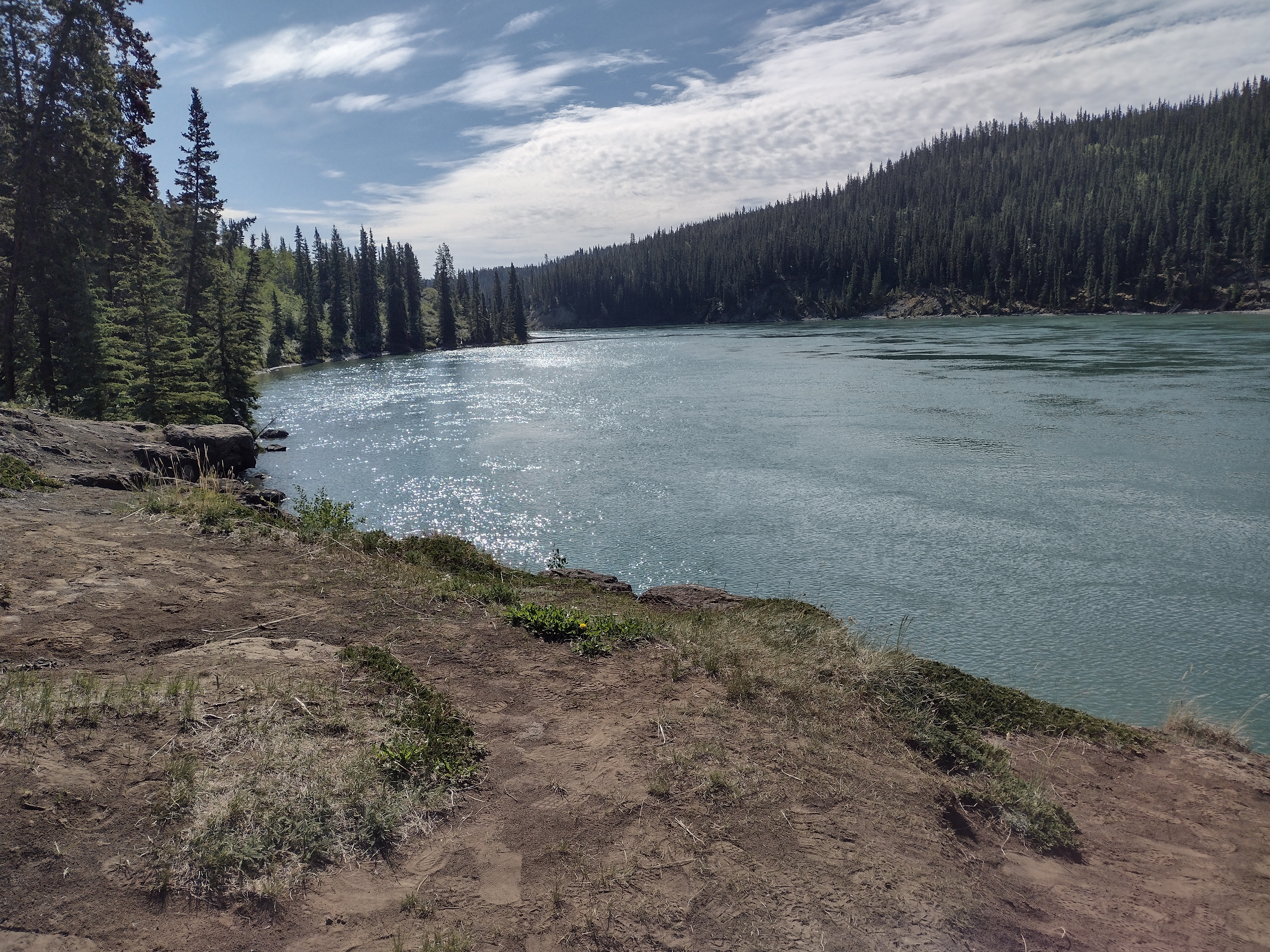
Yukon River
On the pedestrian bridge over the Yukon
Brian (yellow shirt) on the pedestrian bridge that got us to the hiking
trails on the other side.
Yukon River where it enters Miles Canyon
Other sights in Whitehorse:
SS Klondike National Historic Site - last plied the river in 1955
boilers
This is how wood was brought on board to fire the boilers.
Brian looks so small next to the paddlewheel.
Yukon Beringia Interpretive Center
Very interesting place to learn about ice age animals
Mammoth skull
steppe bison skeleton
preserved horse hide - 30,000 years old
preserved gray wolf
preserved caribou
ice age beaver - we think the Bucee beaver in Texas is cuter
Seen while geocaching:
We HAD to find "Logan's Cache" in Whitehorse
World's largest windvane - a retired Douglas DC-3,
we sat and watched it move with the breeze.
sculpture of horse overlooking the city of Whitehorse, Yukon
60th Parallel between British Columbia and Yukon Territory
abandoned equipment used to construct the highway
Hippie Inn with ...
travel bug hotel mounted on the back
Sculpture of Robert Service's desk in downtown Whitehorse with this on the desktop...


No comments:
Post a Comment