August 2, 2023
After leaving the most populated part of Alaska, we drove eastward to Glennallen, then south to Valdez. On the way, we looked toward the Wrangell Mountains but could barely see them because of the haze.
To reach Valdez, we drove through stunning Keystone Canyon and came across some impressive waterfalls.
We were welcomed to the city before entering the canyon.
Bridal Veil Falls
Horsetail Falls
old railroad tunnel
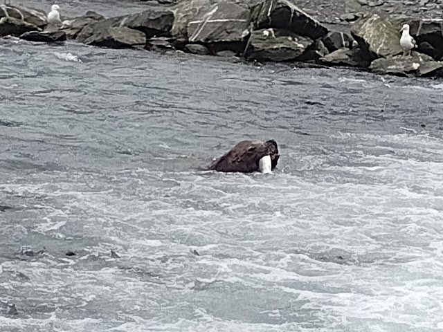
The highlight of our visit to Valdez was the Solomon Gulch Fish Hatchery where we could see salmon trying to negotiate the fish weir and sea lions hanging around for the feast. We also enjoyed the museum dedicated to the relocation of the town after the 1964 earthquake.
At one point, I counted 22 sea lions below the weir.
There were several dioramas of what the original townsite looked like.
After the earthquake, the whole town was relocated to a new site 4 miles away on more stable ground.
We had one more national park we could drive to and it is a doozy ... the largest national park in the U.S. is Wrangell-St. Elias. To save wear and tear on our van, we decided not to drive it into the park on 60 miles of rugged gravel. Instead, we rode on the shuttle van and it took 2 hours on the McCarthy Road to get to Kennicott. We found a lovely campground not far from where we met the shuttle bus that was relatively mosquito-free.
Liberty Falls campground
On this day, we had better conditions for viewing the Wrangell Mountains.
The Kennicott Copper mine closed in 1938. The National Park Service is
stabilizing and restoring some of the buildings. Some buildings are privately owned.
powerhouse

'
The shuttle bus driver spotted this lynx and I shot these pictures
through the window.
I even got a shot of its stubby tail.
old railroad trestle along the McCarthy Road,
railroad was built to get the copper out of the mountains
Our last night in Alaska was in Tok where we started our grand circle on June 23.
The highlighted route shows where we traveled almost 4,000 miles around
the state on most of the paved highways (and a few unpaved ones).
Not far from the Canadian border, we passed through Tetlin National Wildlife Refuge. We saw a few
swans along the way (trumpeter or tundra, I am not sure which ones they were).
A cache (not to be confused with the geocaching kind)
Another uneventful border crossing into Yukon Territory, then we retraced our route on the Alaska Highway as far as Watson Lake before heading south on the Cassiar Highway. Stay tuned . . .


No comments:
Post a Comment